Taula de Torretrencada The prehistoric settlement of Torretrencada is located a few kilometers from Ciutadella. Torretrencada remained inhabited until the end of Roman times and inside many archaeological remains of interest are preserved. In addition to the Taula de Torretrencada, the main remains of the settlement, there are also hypostyle rooms, a Talayot and artificial caves carved by its inhabitants directly in the rocky subsoil.
Article contents
Taula in Torretrencada
The Taula de Torretrencada is located inside the village. Although it is very well preserved,the same cannot be said of the enclosure that surrounded it at the time. This Taula is one of the best known in Menorca, and in addition to the two stones of the main structure, it has a reinforcement column at the back of it. Enclosure of the Taula of Torretrencada (the reinforcement column is appreciated)
How to get to Torretrencada
To reach the village from Ciutadella just follow the road to Maó, and once you pass the turnoff to the Naveta des Tudons, after a few meters you will see the sign indicating the village.
If you have come by car, you can park for free in the parking lot at the parking lot at the entrance. The parking has capacity for up to 5 cars.
From the car park it takes about 5 or 10 minutes to reach the actual entrance to the village.
The trail is quite entertaining as you will pass between dry stone walls surrounded by trees and vegetation. Intermediate fence in the trail to the Torretrencada village
Once There
The visits are free of charge and have the following schedule:
April 1st to November 15th (8am to 9pm)
November 16 to March 31 (8am to 6pm)
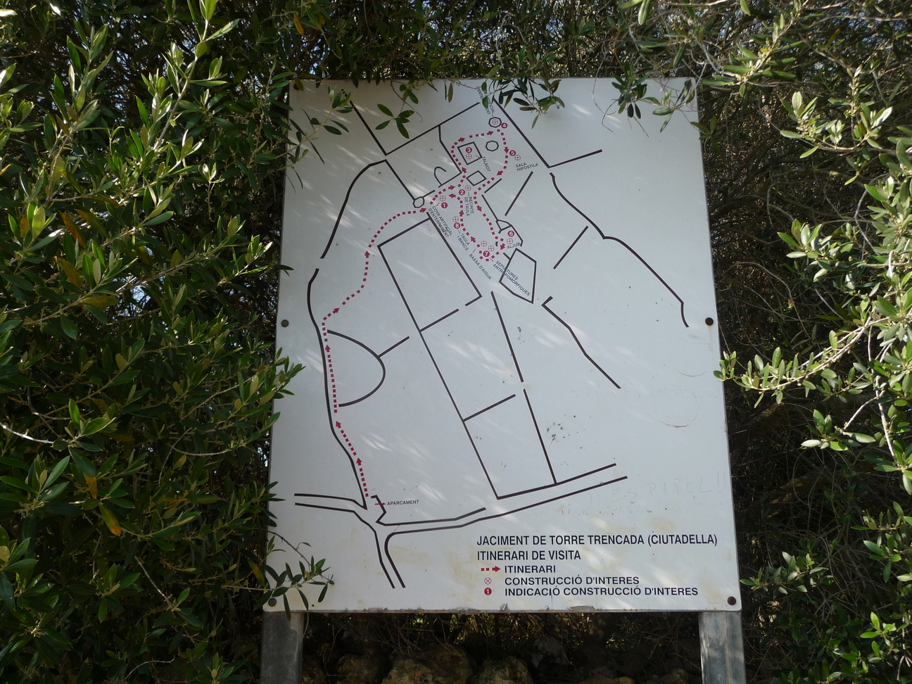
Once in the village, everything that can be seen of the prehistoric remains is quite well indicated. At the entrance there is a sign with the 8 points of interest that can be seen in the village. The most spectacular is probably the Taula, although seeing the water collection “bassa” also has its charm. Informative poster of the points of cultural interest of Torretrencada In addition to the prehistoric remains, there is also an area with a bench and a table built from stones from the village. You can have a historical picnic, on stones used by our ancestors! Reusing stones from Torretrencada village 2
Map and Points of Interest
Photos
Cartel informativo de los puntos de interés cultural de Torretrencada
Valla intermedia del camino de acceso al poblado
Camino de acceso a Torretrencada
Puerta de entrada a Torretrencada y mapa
Mapa de puntos de interés del poblado de Torretrencada
Valla de acceso al poblado de Torretrencada
Recinto de la Taula de Torretrencada
Recinto de la Taula de Torretrencada (se aprecia la columna de refuerzo)
Taula de Torretrencada
Taula de Torretrencada
Talaiot de Torretrencada
Camino de acceso a Torretrencada
Sala hipóstila de Torretrencada
Sala hipóstila de Torretrencada
Cartel de sepultura antropomórfica y charca de recogida de agua
Charca de recogida de agua de Torretrencada
Aljub de Torretrencada (depósito de agua potable)
Cartel Aljub
Cartel de reutilización de piedras del poblado
Reutilización de piedras del poblado Torretrencada 2
Reutilización de piedras del poblado Torretrencada
The castle of Santa Àgueda, located 264 meters above sea level, was built by the Arabs during the Caliphate of Cordoba.
This castle served as a point of defense until 1343 when it was destroyed by Pedro IV of Aragon.
It is currently in ruins, so do not expect to see large buildings when you visit it.
The port of Sanitja or Sanisera is a natural harbor located theoretically next to the ancient Roman city of Sanisera. The port is located on the cape of Cavalleria and has a length of 800 meters, which together with its low seabed makes it a very good shelter for boats when the dreaded Tramontana wind blows.

")