Solo Bike Tour of Menorca (MTB) along the Camí de Cavalls in 6 Days
Última actualización: 20/08/2024
It has taken me 4 years to finish writing this article about the tour around Menorca by bike along the Camí de Cavalls.
In August 2014 I decided to go around Menorca by mountain bike along the Camí de Cavalls.
For this I used a cheap Rockrider bike from Decathlon that was more than 10 years old, and a light backpack of 20 liters approx.
In this adventure I was fortunate to have logistical support by road (they came to pick me up in some stages), but I could have done the same without any support and with much more suffering and dedicating a little more time.
Article contents
Is it possible to cycle around Menorca alone and without help?

The truth is that it is a not very grateful route to do by bike, and I only recommend to do it completely if you consider it as a personal challenge.
It is much better to walk than to cycle, and unless you are a very good cyclist it will take you about the same time.
Minimum Material to do the Camí de Cavalls Bike Tour

If you carry too many clothes and accessories the weight will be too high and you’ll suffer much more in bike-loaded sections.
- Mountain Bike: The lighter the better, as there will be long stretches where you will be carried on your back.
- 2 spare inner tubes: It is very easy to suffer 1 or 2 punctures.
- Light thermal blanket: In case you have serious problems and for sleeping while bivouacking.
- Water: Minimum 2-3 liters per stage
- Windbreaker: Basic if it is windy and to avoid getting cold some bivouac nights.
- Map: It is essential to carry a map to avoid problems.
It is better if it is paper and laminated.
Cautions: Do Not Attempt Without Reading This First
For the return to Menorca I chose the month of August for convenience:
- It is the month with the highest number of tourists on the island.
- All hotels and bars are open
- There are many hours of daylight during the day
- At night it is not so cold and it is possible to bivouac (but the humidity is VERY high).
Surely it is much better to choose the spring months like May or June, and of course it is better not to bivouac and try to spend every night under cover in a hotel. It is important to be in good physical shape to cycle around Menorca.
If you are not used to do bike tours of at least 30 km, or if you do not do some sport at least 3 or 4 times a week, it is better not to try it.
There are affordable cyclotourism stages more suitable for people with a medium or low level of fitness.
When I talk about Departures in the article, I am referring to points where you can abort the excursion in case of problems, or receive road support.
Time and Distance Indications

The times of each stage are conservative: I made the return slowly, considering that I went all the way around the island and that the August heat at noon is suffocating and dangerous.
I stopped frequently to take photos, drink water and rest.
In any case, the times in this article are perfectly acceptable, and if you are competitive you can go much faster.
The km distance of the stages I calculated later using a very rudimentary GPS that I carried during the return.
The cumulative elevation gain was also calculated later with the GPS and I got “only 1.355m”, which is not bad for an island with no elevation gain.
Although the Camí de Cavalls is officially 185km, my total came out to 167 km.
I guess I skipped some parts between the shortcuts and the road support.
Stage 1: From Cala en Blanes to Cala Tirant (August 5th)

Departure at 7.30 from Cala en Blanes: From Cala en Blanes follow the GR223 signs painted on the lampposts (red and white) in the direction of the racecourse.
At the end you reach the beginning of the section towards Pont den Gil. In case you want to skip the first piece of rocks: Instead of starting the Camí de Cavalls you can go to the Hippodrome and at the end of the road there is a fence that leads to the water treatment plant: In principle it is open (the gate has a padlock).
Before reaching the water treatment plant you will see on the right the small path that is the continuation of the Camí de Cavalls from the Pont den Gil; it is on your left.
The disadvantage of the shortcut is that you will not be able to see the magnificent Pont den Gil. You follow the path to the base of Sa Falconera: Although the first part of the climb can perhaps be done by bike, the last part is impossible if you are not a professional.
Anyway, I did it all with my bike on my back.
Once you get to the top, just follow the Camí de Cavalls without getting lost.
It is a very rough section, with many rocks, and the ascents and descents, although in principle not very steep, are impracticable. Walking without a bike you go faster. There is no water all the way, and few places to shelter from the sun. If you want you can swim in S’Amarador, although the descent is not easy.
I came across several people running (trail runners), they were going faster than me . I have never seen a cyclist in this area.
At the end you reach the exit of the section.
On your left is the Punta Nati lighthouse; on the other side is the continuation of the Camí de Cavalls towards Cala Morell.
At this point you have an exit; taking the road to Ciutadella to the right, with a bike lane.
From Punta Nati to Cala Morell

I start at 9.00. It is somewhat better than the previous section, flatter, but also with many rocks, so any fall is dangerous.
I did not find anyone. At 10.30 I arrive at Cala Morell; when leaving the Camí down, you pass the caves of the Necropolis of Cala Morell and go up.
At this point there is another exit; you could take the road to Ciutadella.
It is less dangerous than the main road from Ciutadella to Maó, but in summer a lot of cars pass by.
In Cala Morell, being very urbanized, you can always find a place to have a drink and buy water and food .
I stopped for breakfast in the bar of the apartments of Sa Cala, with swimming pool but without showers. To sleep in Cala Morell there are only apartments and it is very difficult to rent for a day. I recommend the Hotel Rural Biniatram1 Km in the direction of Ciutadella on the left.
Then you can always go back towards Cala Morell to continue along the Camí.
Alternatively, you can ask the owners of the hotel to let you pass through the farm and you can reach the codolar de Biniatram (there are several paths between different farms, you have to follow in an easterly direction towards the sea).
Here you are back on the Camí (jumping over a dry wall).
Review of Accommodation in Biniatram

It is very well located near the Vall; as long as you have a car or bike.
If they refurbished the bathrooms a bit, it would be a higher category, but then I guess they would charge you more.
- The garden and pool are very well maintained; the latter is one of the best in similar places.
The family atmosphere is noticeable. - I was shown the apartments on the first floor and they are really worth it if you go with family.
To continue along the Camí from Cala Morell you have to go up to the end of the urbanization, at the last traffic circle to the left, and then to the right at the next traffic circle, already near the cliff.
You will find the signs for the stretch from Cala Morell to Algaiarens.
From Cala Morell to La Vall

I start at 11.00. This section is much better than the previous two, although there are some rocky sections.
I came across four older Menorcans who came walking from Ses Fontanelles; no cyclists.
The ascent and descent to Ses Fontanelles I did on foot.
At the jetty you have possible shelter, and it’s a pretty good place to sleep if you don’t like the sand (and the extreme humidity of the beach at night). If you find someone watering the garden you can ask for water.
Theoretically in this cove they will make an exclusive platform for the guests of the luxury hotel Can Faustino, so maybe in the future there will be some kind of service.
Continue along the Camí and you will arrive at the Algaiarens parking.
There are public toilets, but water only if you ask someone for it (in summer it is crowded). Again you have an exit; you could take the road to Ciutadella, with a quite hard asphalted ascent, and about three kilometers from the parking to the crossroads of Cala Morell.
Then about 7 km to Ciutadella.
If you cross the parking you will find the indication of the stretch to Cala el Pilar.
From La Vall to Els Alocs
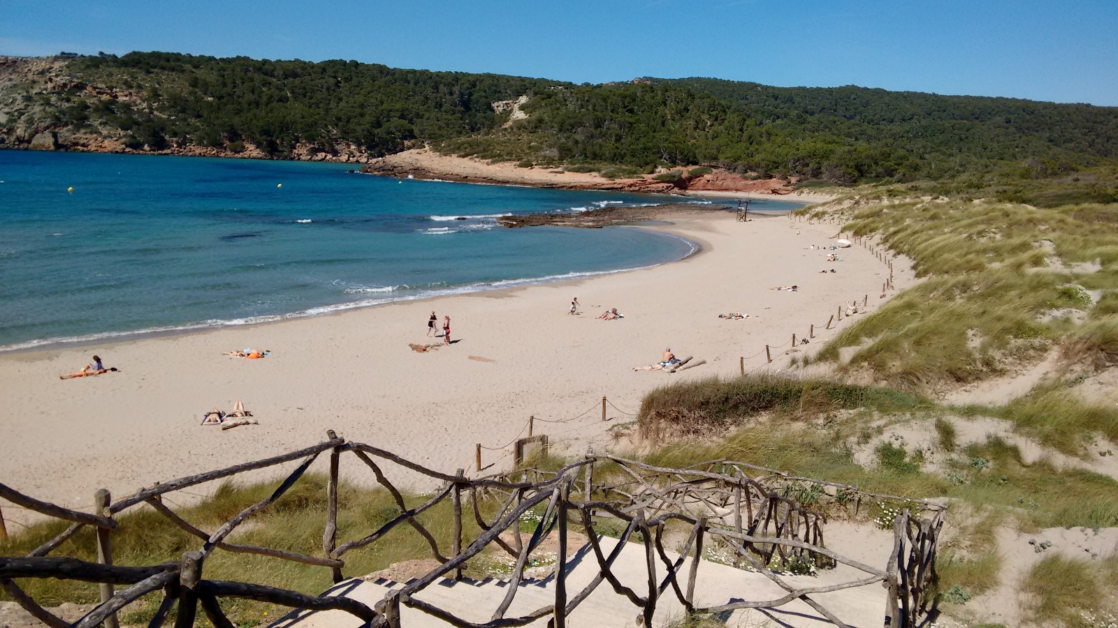
I start at 12.15.
For my taste, the stretch from Algaiarens to Alfurinet is the best of the north coast to do it by bike.
It is a very pleasant ride, quite flat, with some perfectly manageable climbs, although I did some of them on foot so you get less dehydrated.
You can find some cisterns and regs with water, although I’m not sure if it is drinkable (I imagine that animals drink it), it is very good to refresh yourself.
You will find several places with trees to take shelter from the sun and rest, or even sleep. I only met a few people walking from the parking lot to the beach of Es Bot.
On the rest of the way to the Macar d’Alfurinet nobody, although other years I have come across some cyclists.
As I said, for me this is the best stretch for bikes.
From Macar d’Alfurinet to El Pilar

I leave at 13.00.Here there is almost never anyone, because they are all rocks, but it is a good place to swim or dive and see sea bream, if you are not going around the island, because with salt water is more difficult.
To your left is sa Muntanya Mala, with a height of 200 meters and very good views. From Alfurinet to Cala Pilar a quite important and very hard climb, with wooden steps, and that can not be done by bike.
We appreciate the rest area under the trees, in the oak grove of Felip, with benches and a fountain; take advantage of it, you will not find more water until Binimel-là.
The cove is on your left with a good view from above. At 13.35 I arrive at the rest area El Pilar in the Encinar de Felip:Here you have a possible exit: in fact I met two people who were doing the tour around Menorca like me, but in the opposite direction.
They told me that everyone recommended them not to do the Binimel-là Pilar section, because it was up and down cliffs, and you couldn’t carry your bike on your back.
They had gone from Binimel-là to Mercadal, then to Ferreries and had taken the general road to the Pilar detour to resume the Camí de Cavalls.
They were partly right (see below), but I’d rather die dehydrated than run over, so I continued along the Camí towards Els Alocs.
In case you decide not to continue, the descent from the Felip holm oak grove to the parking is quick by bike (those who walk up take more than half an hour) and then you have a stretch of asphalted road to the main road.
Here on the left is Ferreries at about 5 km and Ciutadella on the right at 11 km.
It is a very dangerous road, because there is hardly any hard shoulder and there are long straights where cars and buses go fast; from my point of view a very dangerous stretch.
- Another alternative to go to Ferreries, is to go towards Ciutadella, and take on the left the road to Torrellafuda or Torretrencada to go out to the old road from Ciutadella to Ferreries crossing the ravine of Algendar. The first detour is closer (about 2 km), but you have to know the way because you will have to cross a farmhouse.
The second one through Torretrencada (about 3.5km) is easy to follow. - There is also a detour by a private road before Torrellafuda, but the gate is closed.
In any case, crossing the road is very reckless in my opinion. - Once you arrive in Ferreries, continue towards the village (do not go through the tunnel), past the Wimpy (a good place to recharge your batteries), at the next traffic circle turn left towards Ca Na Xini (a good hotel) and go up.
At the end of the climb go down the dirt road, passing through some farmhouses, and you will reach the roads to the northern beaches where you can head towards Binimel-là.
14.00 I leave from the rest area of the holm oak forest to Els Alocs.
You go down towards Cala el Pilar and then continue the Camí to the right.
There are many rocks and you do it with the bike on your back.
From Els Alocs to Cala Tirant
I start at 14.30 from Els Alocs. In the hut near the beach I meet 3 people drinking whiskey before the meal.
They give me mineral water that they only use for cooking.
I ask them about the way to Binimel-là; one of them tells me that it is very hard, especially up to Cala Calderer.
That you have to be very brave to do it and that even if I give him a thousand euros he won’t go with me.
They wish me luck.
Here is another exit point:
- If you continue in the opposite direction to the sea you will reach the parking lot.
From there you could take the camino dels Alocs back to the main road.
Pray before crossing to go left to Ferreries.
I arrived at Cala Calderer at 4.30 pm. It is a very hard stretch; in full sun you have to go up and down the cliffs with the bike on your back. If you don’t have enough water (at least two liters) don’t even think of doing it.
Halfway up there is an old building, which can serve as a shelter.
Arriving at Cala Calderer you find a hut.
When I passed there were some Menorcans eating; they offered me food and water.
They told me that I had already done the hardest part and that if I went a little fast, I could reach Fornells in a couple of hours.
I don’t think they had ever done the Camí by bike.
On the other side of the cove there is a house; that is, at this point you have another exit, although I’m afraid they are private roads. The route to Cala Barril is almost as complicated as to Calderer, but it is shorter. Once in Cala Barril the way to Cala Pregonda is easy; especially considering where you come from.
From Pregonda to Binimel-là just five minutes.
Cala Calderer and Cala Barril are good places to sleep assuming you have water and food.
If you sleep in Pregonda or Binimel-là, you can have a drink before at the Binimel-là beach bar if you don’t arrive too late.
From Binimel-là you have an exit along the road to the northern beaches, either to Mercadal or Fornells.
I arrived at Binimel-là at 17.45.
Binimel-là Restaurant

I had a melon and water at the Binimel-là restaurant (next to the upper parking lot), and rested a bit.
In addition to the beach bar, there are public toilets next to the parking lot.
From Binimel-là to Cala Cavalleria
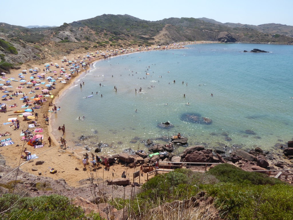
At 19.00 I leave Binimel-là towards Cala Cavalleria,until I reach Cala Mica the road is quite difficult, then it is relatively flat until I reach Cavalleria.
I cross the beach of Cavalleria with the bike until I reach the stairs on the other side.
After the effort of crossing the beach, climbing the stairs is very hard.
I imagine that they saw my suffering face because a person took my bike up to the top.
I imagine there must be some shortcut to avoid the beach, because horses obviously can’t get through here.
Once you reach the parking of Cavalleria you have to go left along the road towards the spectacular lighthouse of Cavalleria, and you will find the beginning of the new section on the right, right next to the Roman settlement. Up to Cala Tirant the road is quite good, but with some difficult climbs, especially near Cala Tirant, which is very hard.
I was passed by a person running; he arrived before me. In the little cove before reaching Cala Tirant you have a possible place to sleep, as there is a jetty with a thatched roof. When you get to Cala Tirant you have to cross the beach in a moment.
I instead headed to the right, leaving the cove behind, to the road, turning then towards Fornells and then taking the detour back to Tirant.
A U of about 8 km.
I had a well-earned cold beer and something to eat at Bar Okapi in the urbanization of Cala Tirant,
then slept on the beach of Cala Tirant.
Although it is summer the sand is very wet.
I used a light thermal blanket as a mattress and slept on it.
In August it is not very cold.
You have to take into account that it is the only beach close by, so I shared it with young people drinking.
Stage 2: From Cala Tirant to Sa Torreta (August 6th)

From Cala Tirant to Son Parc
I left Cala Tirant at 7.30 am. I went to have breakfast in Fornells.
You can do it at Hostal la Plaça, but if you want to save the story told of the adventures of those who come on a spree, it is cheaper to stop at the bakery in the adjacent street. In Cala Tirant and Fornells you have all services, including hotels and restaurants. I left Fornells at 8.20.
You take the road to Es Mercadal (there is a section of bike path) and at the traffic circle take the left turn to Son Parc/Addaia.
Watch out because about 400 meters to the left you have the entrance to a farm where the section of the Camí begins.
Be careful, you have to cross the road, and it is downhill.
The road to Son Parc is very easy.
I came across two cyclists going in the opposite direction.
From Son Parc to Addaia

From Son Parc to Addaia
I leave Son Parc at 8.50 a.m.When you leave the Camí if you go left towards the beach you will find a beach bar.
At the back there are toilets and, more importantly, showers.
Although they have a door I have always found them open.
Son Parc is also very urbanized with all kinds of services. Here you have two alternatives;
- You can cross Son Parc beach and climb the stairs on the other side, passing by another beach bar (not a bad place to eat; I had a juice and rested a bit).
It is smoother than crossing Cavalleria. - You can exit the parking lot in the opposite direction to the beach and head towards the other side.
To take the Camí you have to go in a northerly direction, towards the sea, passing the forest park.
The entrance is on the street of the cliffs, about 450 meters to the left.
The Camí runs along the side of the cliff; you can ride a bike but it is very rocky, dehydrating you a little in each boat.
I met several people walking along it.
I left for Arenal den Castell at 10.00 and reached the Arenal in 30
minutesOnce at Arenal den Castell, follow the painted signs.
When you leave the Camí, you go left in the opposite direction.
At the end you will find a last descent down to sea level. Go down, then you will have to climb a lot of stairs, passing a bar and a supermarket.
- An alternative is to continue in the opposite direction to the right instead of taking the descent: you will arrive at the same place without climbing stairs.
- Once at the top, continue along the paved road, on the left if you have climbed the stairs.
About 2 km further on, once you leave the beach behind, the signs will take you to the left, turning around to avoid sharing the road with cars.
But to the right is uphill, in case you don’t have enough, so I recommend that you don’t follow the signs and go straight on where the cars go.
It is a short stretch until the turning to the left to Addaia, just two kilometers ahead.
Once you take the detour you reach Addaia in a few minutes.
I arrive at Addaia at 11.00.
From Addaia to Favàritx
In Addaia you don’t have to go to the pass; go straight on and at the traffic circle go to the right following the signs to get to the beginning of the Camí itself.
The stretch up to Pou den Caldes is one of the best in the north for cycling (except La Vall-Alfurinet), especially when you pass through the area of the salt pans.
Then you have a couple of ramps with wooden steps.
The descent to the Pou den Caldes is hard, and then the climb for me is impossible.
Here I saw a cyclist (a very good one) who did both the ascent and the descent on the bike, although in the opposite direction (coming from Favàritx).
I tried to find an alternative path to the ascent from Pou den Caldes, but I got lost and ended up crossing farms (even with no trespassing signs).
To avoid problems I went back to the Camí, although a bit further back from where I was.
The scary climb turned out to be not so scary (after Cala Calderer nothing seems hard).
At the top there is a hut in very bad condition that only serves as a shelter if it rains (get under the lintel just in case).
Then the path is relatively easy and fast, downhill, until you reach the road to the Faro de Favàritx lighthouse. 
Turn left towards the Favàritx lighthouse, continue for about 1.8 km to start the next stretch towards Cala Tortuga.
I arrived at Faro Favàritx at 13.30.
From Favàritx to Sa Torre Blanca.
I was lucky enough to be picked up by my wife by car to go for lunch at the Pinomar Restaurant in the urbanization of Son Parc: 30 years of Granada experience.
In the afternoon I restarted the Camí from the Favàritx lighthouse, leaving at 16.30. 

The opening is after a fence with a prohibition sign.
I made a mistake and went up the road, and I got an earful from the apparent owners of the lloc.
The bike only passes vertically.
You go up through the fields until you reach the accommodation Sa Torre Blanca. Here the typical tourists will never arrive.
Joan Simón and Àngels, wonderful hosts.
At 18.00 I was already in Sa Torre Blanca.
My opinion about Sa Torre Blanca

It is the typical place where you will not find the typical tourists.
Rural Menorca in its purest form.
To go for dinner or lunch you need a car or a bike.
You have the cove at 15 minutes walking and surely there will be nobody.
Relatively cheap compared to other rural hotels.
There are only two rooms, the tower itself, and an apartment where I was.
It has a fridge and is very cozy. If you want tranquility this is the place.
I think they will eventually expand.
Stage 3 – From Sa Torreta to Punta Prima (August 7)
From Sa Torreta to Sa Mesquida
In the morning, after a good breakfast, I left at 12.30 in the direction of Cala Sa Mesquida.
From Sa Torre Blanca we went down to Sa Torreta and took the Camí to the right. It is not very difficult, although you always find steep slopes, where if you are not very good, it is better to get off the bike if the sun presses.
- The arrival to Es Grau is flat.
At the end, you have a stretch of road of about 750 m, which is dangerous. - Keep an eye out for the sign and cross to the left to rejoin the Camí.
- Then up to Sa Mesquida similar to before, with some climbs.
We arrive at Sa Mesquida at 14.00, but we stop half an hour to change a flat tire. In Sa Mesquida we had a good paella with my family on the terrace of Cap Roig, a good restaurant with excellent views.
My opinion of Cap Roig Restaurant
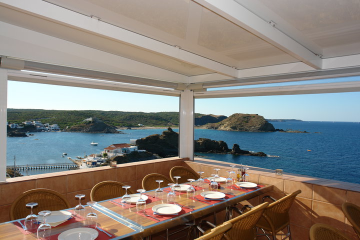
One of the best considered restaurants in the guides.
Spectacular view of the bay.
We had paella with my family.
The price is relatively high so it can’t be considered a simple beach bar.
We had a very good paella and they were a bit slow, especially for the desserts and to charge.
From Sa Mesquida to Maó

From Cap Roig to Maó the Camí is by road. It is better to do it as fast as possible because it is a bit dangerous.
There are quite a few changes of gradient and the cars go fast.
At the beginning it climbs a bit (and more after the paella), and then you have a gentle descent to the port of Maó.
I arrived in Maó in 10 minutes.
From Maó to Es Castell
The Camí continues through the port of Maó on the right side looking towards the sea, to climb at the end to the town center to take the road to Es Castell.
I instead made the climb along the Ronda de Maó (and I’ve seen the port dozens of times), which leads to the main road, then turn left and head to the city center along the Avinguda de Josep Maria Quadrado to the Plaça de S’Esplanada.
You continue towards the port and in 100 meters you turn right towards Es Castell.
If you have gone through the port of Maó, when you go up to the town center you follow the Camí signs, towards Es Castell.
Previously I called the Hotel del Almirante Collingwood House, and they had a single room: I had dinner and slept at the hotel.
My opinion of the Collingwood House Hotel

It’s a place to go if you’re on a tight budget and not too far in advance.
It feels like you’ve gone back in time a bit.
I think the hotel needs a little renovation.
The best thing is the view of the harbor and the pool to cool off.
The restaurant has a very acceptable menu and the staff is friendly.
My opinion about Santa Rita Restaurant
In the evening we went by car to have dinner in Maó (I had road support 🙂 ), at the restaurant Santa Rita in Plaça Bastió.
It was a great discovery in Maó.
The food is different, with elaborate tapas and affordable price.
We will be back for sure.
Stage 4 – From Es Castell to Binigaus (August 8)

From Es Castell to Punta Prima
I left the hotel at 9.00 am. After breakfast at the hotel I left at 9.00 following the road.
You pass the Es Castell detour until you reach Cala Sant Esteve. You go down to Cala Sant Esteve, cross it and then you have a climb that is impossible by bike.
When I got to the top I met an Italian on a bike.
I asked him if he would go down and he told me he would not.
He showed me a scar on his shoulder from a fall he had in a similar place (not in Menorca) and since then he is more careful. You continue along the Camí leaving Fort Marlborough and the sea on your left.
Then you have 1 Km flat but quite bumpy. At the height of the pylon 69 go straight on.
There is a very easy section, one of the easiest so far.
At pylon 053 (be careful, when I passed #3 it was erased) you will see on your left a wall with a small opening; the bikes only pass vertically.
It’s worth it because if you cross it and go down through the forest you will see Cala Rafalet,
on the esplanade before you get to Rafalet you could sleep, although there will probably be others who have thought of the same thing; when I passed there were three people with sleeping bags.

You go down to the beach and you will see the historic chiringuito Xuroy, now with rooms too.
The Camí continues on the other side of Cala Alcaufar.
- Then it is a very easy bumpyride back to Punta Prima.
- It is very urbanized so you find all the services, supermarkets, hotels, restaurants.
I arrived a little before 11.00 and rested for a while drinking water and juice.
From Punta Prima to Cala en Porter
I leave Punta Prima at 11.30 am. You have to go up towards Torre Son Ganxo, with a short stretch along the seashore until you find the exit to the road.
Then you turn left; the first stretch indicated is in the opposite direction (there are some other short stretches of the Camí where the same thing happens), so be careful.
- You arrive by road to Binibèquer Vell; although it is a nice village to take pictures, it is full of tourists; better to pass by.
- El Camí continues past the bus parking.
- I arrived at 12.00 at Binibèquer Vell, and I rested a little taking fruit.
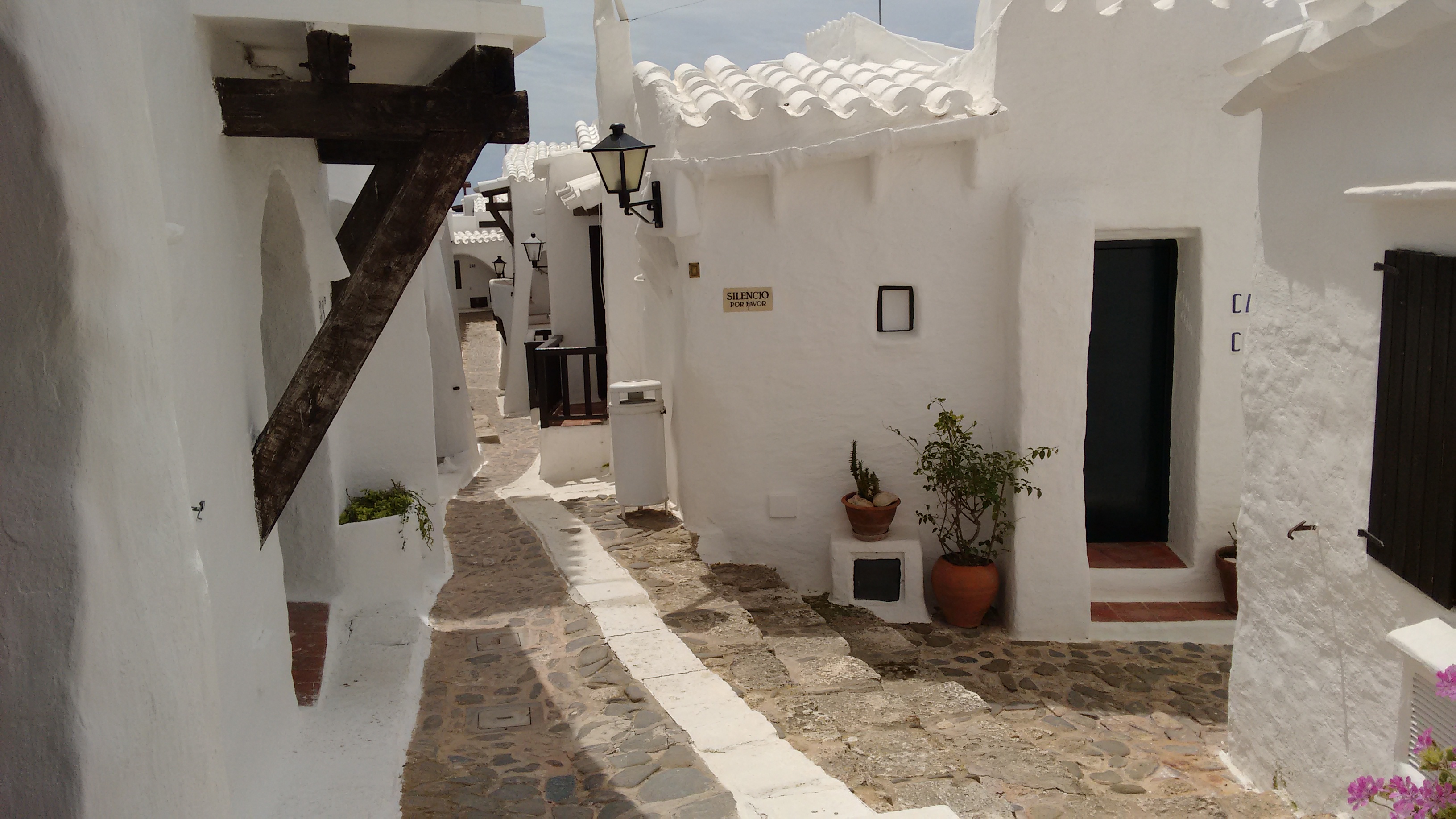
When you come out, follow the asphalt road to your left (Avenida Platja Binisafúller) for about 500 meters and you will find the Camí turnoff to Cala en Porter on your right. I took the detour to Cala en Porter at 13.00.
- The first piece is easy, with a few boats.
- When you pass some houses at pylon 127 do not go right on the narrow road; you must turn left.
- Further on you come out onto a tarmac road to the left, and after 1.7 km you reach the urbanization Mar Menorca.
Inside there is a swimming pool with access only for clients… - You continue straight through the urbanization on the main street (ignore the prohibition sign).
- You go down to es Canutells, cross the cove, and then the climb is difficult (again on foot).
Then the stretch is easy but with stones.
The descent to Ses Coves is difficult.
Before arriving, in the middle of the forest, you can stay to sleep.
Here you have a possible exit going up to the parking. You continue along the Camí leaving the Cala en Porter on your left (although you can go to see it).
The climb is impossible.
After a flat stretch there is a last descent to a ravine and from the pylon 6 a last slope although smoother than the previous ones.
Leaving the asphalt road you go left and then right. You will reach the top of Cala en Porter, near the Coves den Xoroi.
Go down to the beach. I arrived at 15.30 in Cala en Porter.
In the area of Cala en Porter you can find all kinds of services.
I ate something at the last beach bar near the entrance to the beach.
From Cala en Porter to Binigaus

I left Cala en Porter at 17.00. I left in the direction of Son Bou a little before 17.00. You head in the opposite direction of the cove. To the left of the climb you will find the entrance to the path that heads towards the ravine.
You pass a house, and then you have a climb that can be done because there are several curves that reduce the slope of the climb. Then the descent to the ravine for me is impossible.
You have a climb, a flat stretch, but overall quite easy and pleasant.
In a section that can be reached by car; I met a couple who came by car from Cala En Porter (on the other side) and were looking for access to Cala Llorenç.
After a while you come out onto a half paved road, to the left towards Llucalari.
The descent to the cove is criminal, honoring the cliffs and caves that can be seen from the sea. It is worth coming to swim or snorkel in Llucalari.
I only found nudists who apparently made life in the cove; although the access is not difficult you have to know it. After the ascent from Llucalari you will come out again to the asphalt, in Son Bou, very urbanized and with all kinds of services.
- You have to cross all of Son Bou, behind the beaches on your right.
- It is not very well signposted, so if you get lost you head to the Jardi de Menorca Hotel and go down leaving it on your right to re-enter the Camí at the end of the descent.
- From there to the beach of Atalis is very flat and fast, crossing the ravine des Bec, where in summer there are always goats.
I arrived at Atalis at 19.00 and bathed. Behind is the finca and hotel Atalis (an expensive place).
At 19.45 I continued by the sea to the beginning of the beaches of Santo Tomás; you get there in 10 minutes.
You can take a shower in one of the outdoor facilities of the hotels.
We had dinner at the restaurant Es Pins de Santo Tomás.
To sleep, the beach of Atalis is quieter than Son Bou, where there are many hotels and apartments and there will always be people.
But as I was already in Santo Tomás I continued along the Camí that runs along the beach in front of the buildings, passed the last beach bar and went to Binigaus.
There was only one other person, a canoeist, who slept there, but quite a bit further; the beach is very large.
As it was a full moon I didn’t even need a flashlight.
It was cold.
Stage 5 – From Binigaus to Cala Galdana (9 August)

I left Binigaus at 8.00.In my opinion one of the best stretches of the south to go by bike (and therefore of all the Camí de Cavalls).
Proof of this is that I met cyclists in both directions, and some people on foot. Proof of this is that I met cyclists in both directions, and some people on foot. In this part of the island are the ravines.
If you have time take the opportunity to see them walking a little when you cross them (Trebalúger twice), it is worth it.
What is the disadvantage if you want to see the ravines?
You have to go down them and then climb them.
Some climbs are almost impossible, like for example the end of Cala Mitjana, but I have seen people who do them by bike.
I’m not so good and I do the difficult sections on foot.
I like this section better in this sense than starting from Cala Galdana.
During the route you only pass Cala Mitjana as the Camí runs a bit far from the coast, so you leave Escorxada, Fustam and Trebalúger on your left, without seeing them.
When you go up from Cala Mitjana, about 200 meters before leaving the asphalt, on your left there is a marked path to go to the viewpoint to see the cove from above.
When you get to the asphalt you go straight ahead and at the access traffic circle on the road to Ferreries turn left down to the cove.
In my case I turned right to go to the Hotel Rural Son Triay, whose detour is about 5 km further on the left. For people doing the route the other way round, from Cala Galdana to Binigaus:
- At the traffic circle at the top of the cove, turn left if you are coming from Ferreries, and go straight on until you reach a dead end traffic circle; the Camí starts there.
- You can also walk to Mitjana from here, as an alternative to the parking lot on the road from Ferreries to Galdana.
I arrived in Cala Galdana at 10:00.
I had breakfast in a bar near the traffic circle, rested, and then went to the hotel.
I arrived at the hotel around 12.00 (30 minutes, it’s uphill).
It was a very short day of cycling to rest.
So we took advantage and went by car to Binigaus (a few hours before I had been there) and had lunch on the beach.
The rest of the day we rested at the hotel pool.
My opinion of Hotel Son Triay

Hotel Son Triay is a good rural hotel in a very pleasant rural setting.
Both the house and the garden are impressive.
You can tell it must have been the country house of some nobleman or other.
The toilets, at least the one in my room, needed a little renovation.
- The swimming pool next to the tennis court is very nice.
- Although we did not dine there the breakfast is very good (in the evening we went to dine at Es Barranc in Cala Galdana with my wife and I).
Stage 6 – From Cala Galdana to Cala en Bosch (August 10)
From Cala Galdana to Cala en Turqueta

I left Cala Galdana at 11.15 am. After a good breakfast, I left the Hotel Son Triay to Cala Galdana, which has all kinds of services.
I bought water in a supermarket and headed towards Cala Macarelleta.
The access to the Camí is on the far right side of the cove facing the sea. The first climb is a bit tough, then you have a very nice walk to Cala Macarella, mostly downhill, the last descent to the cove being very technical.
The climb up the other side of Macarella and the descent to Macarelleta are impossible for me.
In Macarella you have the famous chiringuito SusyYou don’t eat badly and it’s not very expensive.
The trip to Cala en Turqueta is a pleasant walk.
I arrived at Cala Turqueta at 12.30.
From Cala en Turqueta to Cala en Bosch.

Again there is an impossible climb, and then the Camí runs close to the sea.
It is flat but with many rocks until Es Talaier. I arrived at Es Talaier at 13.10.
I rested 10 minutes taking fruit and continued. From Es Talaier to Son Saura is similar to the previous one: flat near the sea and with many rocks.
Then you have to cross the beaches of Son Saura, as the Camí continues on the other side.
In Es Talaier and Son Saura you have public toilets.
In Son Saura you have an exit on the road to the southern coves (Son Saura, Turqueta and Macarella) that leads to Ciutadella,
from Son Saura to Son Xoriguer the road runs along the sea and is VERY rocky.
Halfway you will find the Cova des Pardals:
- To the Cova des Pardals you go down some stairs next to a small white house with red tiles.

You will see the stone steps.
From there you can go to Ciutadella.
This way you can go by car to the fence.
I arrived at Son Xoriguer at 15.00. At the entrance of the beach you have showers and there are restaurants.
To Cala’n Bosch it is only 20 minutes and there are also showers on the beach.
The area is very urbanized with all kinds of services. All the last stretch from Es Talaier to Calan’ Bosch is flat and between rocks by the sea, but it is a lot of fun.
I ate in a pizzeria at the lake of Calan’ Bosch and headed towards the lighthouse of Artrutx at 16.00.
From Cala en Bosch to Cala en Blanes

Leaving the lighthouse behind you starts the Camí de Cavalls, which runs along the sea, is very flat, and with many rocks, but easier than the previous ones.
I came across two people walking with dogs, but no cyclists. You will come out onto a paved road before Cala Blanca.
You have to go to the other side of the cove and continue on asphalt towards the sea to retake the Camí.
You will reach Santandria in 15 minutes.
Just when you reach the edge of the sea, there is a possible confusion; the Camí does not run alongside the water, it is a little inland. When you get to Santandria, again you have to cross the cove and go to the other side, towards the sea, pointing to the watchtower at the entrance of the cove. From Santandria to Sa Caleta is only 10 minutes,I arrived at Sa Caleta at 17.45, because I lost time finding the directions in Santandria.
In Sa Caleta again the Camí is taken on the other side, towards the exit of the cove.
Keep in mind that in the area of Santandria and Sa Caleta the path is not very well signposted.
You have to be attentive and if you walk a stretch (I would say more than 250 meters) without finding the indication retrace your steps.
After a while from Sa Caleta you come out on the asphalted road towards Ciutadella, passing by the terminal of the new port and up to Platja Gran.
From here you take the bike path to Plaça dels Pins and Es Born.
The Camí continues along Sa Muradeta but in the opposite direction.
- An alternative is to go down to the port from Es Born and go to the other side (the shortest).
- Another way is to enter Ciutadella up to Santa Clara street, cross it and go along the port at the top.
- In any case you have to go to the Camí de Sa Farola, where a bike path to Cala en Blanes starts,
I arrived at Cala en Blanes at 18.45 after a short stop in Ciutadella.
Here I ended my adventure around Menorca by bike.


