Camí de Cavalls – Everything You Should Know
Última actualización: 21/09/2023

The Camí de Cavalls de Menorca (GR-223) is a famous 185 km path that circles the island very close to the coast. It is historical heritage of the island and declared of cultural interest by the Autonomous Community of the Balearic Islands (CAIB).
Article contents
History of the Camí de Cavalls
It is not possible to establish the exact origin of the Camí de Cavalls, but we know that during the 18th century it was used for military defense purposes, since it allowed the military authority to watch over the coasts. It was also used by pagesos (farmers) and its access was free for everyone.
Throughout the twentieth century the Camí de Cavalls suffered a noticeable deterioration, mainly due to its lack of maintenance and disuse of some of its sections.
In order to effectively recover the usefulness of the Camí de Cavalls, it was enacted in 2000,
Law 13/2000 of the Camí de Cavalls
whose main objective was to establish a public passage over the original route of the Camí de Cavalls, to allow its general, free and gratuitous use.
Walking the Camí de Cavalls on foot or by bike

Thanks to the law 13/2000 of the Camí de Cavalls (CdC or GR-223), the CdC is a very busy place for hikers and tourists on foot, on horseback or by bike, who enjoy the magnificent views and the fauna and flora of Menorca.
If you are interested in walking the route, check the difficulty of the sections or stages you want to do beforehand.
- There are some sections that can be done by bike, but there are others that are very difficult unless you are on foot.
- However, if you are skilled with your mountain bike, you can ride several sections of the Camí or even ride around the Camí de Cavalls by bike.
the Camí de Cavalls by bike.
.
Since April 2010 the Camí de Cavalls can be walked in its entirety . This means that it is possible to walk all its sections without impediments from beginning to end.
Here you have my guides to go around the Camí de Cavalls, on foot or by bike:
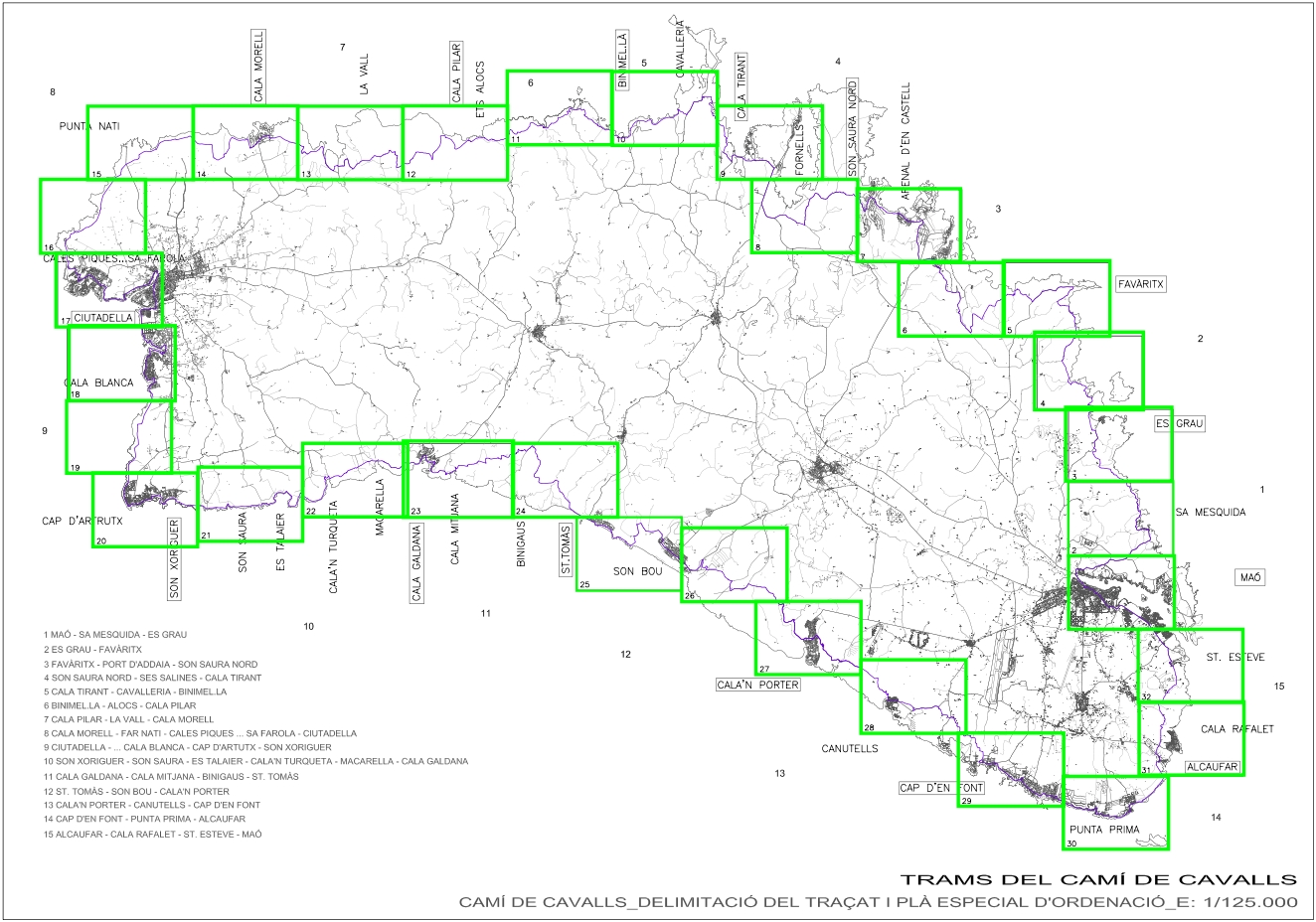
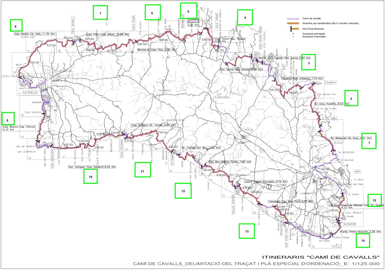
The 20 Sections of the Official Guide

The official guide of the Camí de Cavalls online offers detailed information about each section:
- Accurate information on the distance of each section
- Elevation data
- Detail of fauna and flora
- Beaches and Points of Interest
- Difficulty of each section and safety information
You can check the information following the links below.
- Maò > Es Grau(Distance: 9.96km , Elevation gain: 244m, Maximum height: 65m)
- Es Grau > Favàritx(Distance: 8.50km , Elevation gain+: 197m, Maximum altitude: 46)
- Favàritx > Arenal d’en Castell(Distance: 13.50km , Elevation gain: 284m, Maximum height: 78m)
- Arenal d’en Castell > Cala Tirant(Distance: 10.80km, Elevation gain+: 154m, Maximum height: 38m)
- Cala Tirant > Binimel-là(Distance: 9.48km, Elevation gain: 235m, Maximum height: 47m)
- Binimel-là > Els Alocs(Distance: 8.76km, Elevation gain: 379m, Maximum height: 118m)
- Els Alocs > Algaiarens(Distance: 9.61km, Elevation gain+: 304m, Maximum height: 81m)
- algaiarens > Cala Morell(Distance: 5.39km, Elevation gain+: 150m, Maximum height: 78m)
- Cala Morell > Punta Nati(Distance: 6.96km, Elevation gain: 128m, Maximum height: 106m)
- Punta Nati > Ciutadella(Distance: 10.50km, Elevation gain: 137m, Maximum height: 60m)
- Ciutadella > Cap d’Artrutx(Distance: 13.00km, Elevation gain+: 99m, Maximum height: 20m)
- Cap d’Artrutx > Cala en Turqueta(Distance: 13.20km, Elevation gain+: 122m, Maximum height: 28m)
- Cala en Turqueta > Cala Galdana(Distance: 6.38km, Elevation gain: 172m, Maximum height: 52m)
- Cala Galdana > Sant Tomàs(Distance: 10.4km, Elevation gain: 216m, Maximum height: 79m)
- Sant Tomàs > Son Bou(Distance: 6.43km, Elevation gain+: 117m, Maximum height: 30m)
- Son Bou > Cala en Porter(Distance: 7.92km, Elevation gain: 170m, Maximum height: 81m)
- Cala en Porter > Binisafúller(Distance: 11.60km, Elevation gain: 182m, Maximum height: 61m)
- Binisafúller > Punta Prima(Distance: 8.06km, Elevation gain: 96m, Maximum height: 17m)
- Punta Prima > Cala de Sant Esteve(Distance: 7.20km, Elevation gain+: 74m, Maximum height: 37m)
- Cala de Sant Esteve – Maò(Distance: 6.00km, Elevation gain: 88m, Maximum height: 41m)
Where to Sleep in the Camí de Cavalls
If you want to know in which hostels, hotels or apartments to stay along the Camí de Cavalls, it is best that you consult the
Guide of the walk around the Camí de Cavalls in 7 days.
.
Trail Camí de Cavalls

If you like extreme cross-country, I recommend you to take a look at the Trail Menorcawebsite.
You can sign up for one of the ultra-trail races through the Camí de Cavalls, held in May every year. The most popular races are:
- Trail Camí de Cavalls: 185 km,only for the “bravest”
- Trail Costa Nord: 100km.
- Trail Costa Sud: 85 km
Books about the Camí de Cavalls

In addition to the Guide of the Camí de Cavalls,there is another guide of the Alpine publishing house with hiking and MTB trails through the Camí de Cavalls (Gr-223).
This guide has been on sale since February 2011 and was very successful in the Balearic Islands and Catalonia.
The guide is written by Jaume Tort and can be purchased in Catalan or in its trilingual version (Spanish, German, English).
You can buy the guide using these links:
- Buy Menorca Guide – Camí de Cavalls GR-223 – Excursionist Guide and Map (CATALAN)
- Buy Guide Menorca – Camí de Cavalls GR-223 – Excursionist Guide and Map (TRILINGUAL)
You can also buy the
MenorcaDifferent Guide in PDF
which contains summarized information quite convenient to visit the island and carry it in your mobile or tablet,
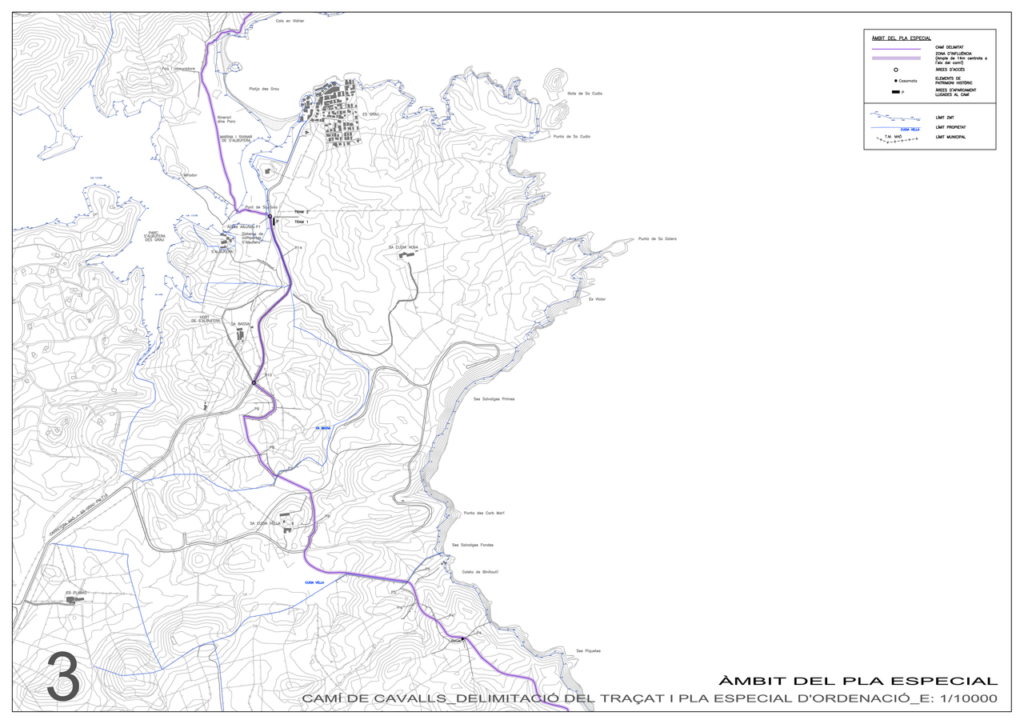
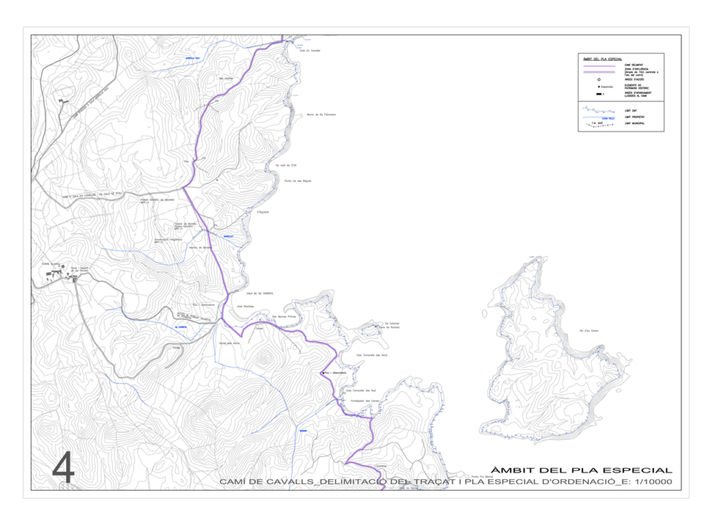
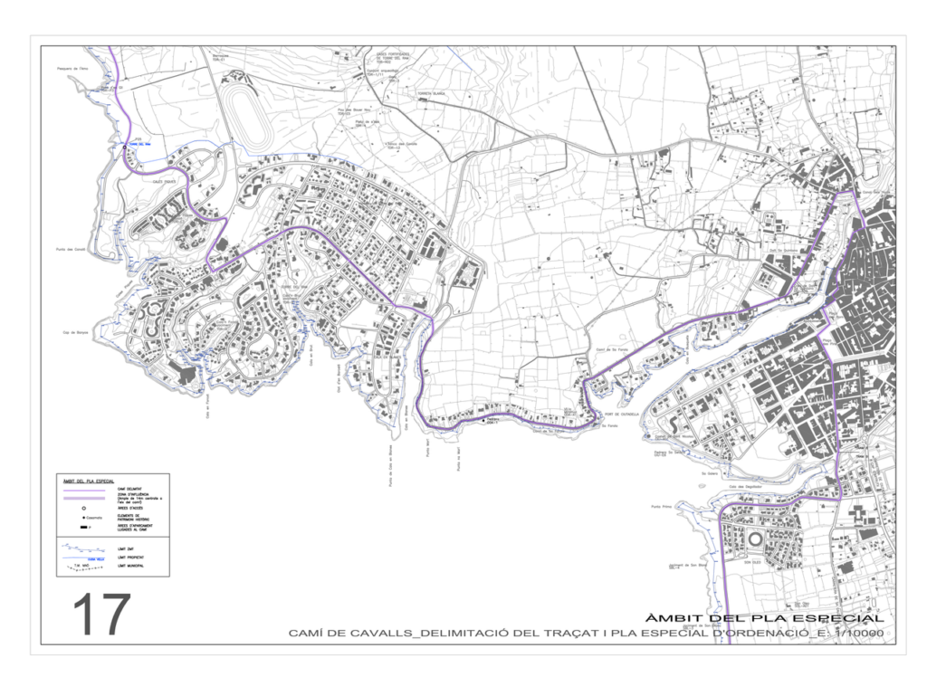
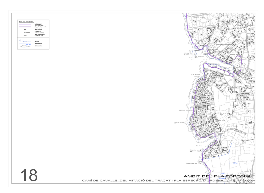
Maps of the Camí de Cavalls
If you are sure that you want to do some excursion in the Camí de Cavalls, I recommend you check the maps below. It is also advisable to visit a nearby tourist information point to know the state of the Camí, as it may vary from year to year.
In case you want to get information about the routes and their difficulty, the best thing to do is to buy the
Guide of the Camí de Cavalls
published in 2009.
- Interactive map of the Camí de Cavalls (Official map)
- Download Map Camí de Cavalls (PDF – 4MB)

Avoid Fines in the Camí de Cavalls
According to the law of the year 2000, the alteration of the signs of the Camí de Cavalls is considered a very serious infringement, punishable with fines of 30,000 to 150,000 EUR.
So be careful with the cairns that mark the road, don’t break one!
My Recommendations for the Camí de Cavalls

If you want to do the Camí de Cavalls by bike or on foot, here you have an index of the stages that I have done and documented (Actually I have done them all, but I have not been able to write it down yet).
The difficulty refers only to walking, since all stages are of high difficulty if you want to go on mountain bike.
- Maó <> Es Grau (9.96 km, medium difficulty)
Es Grau <> Favàritx
(8.53 km, medium difficulty)- Favàritx <> Arenal d’en Castell (13.5 km, medium difficulty)
- Arenal d’en Castell <> Cala Tirant (10.8 km, low difficulty)
- Cala Tirant <> Binimel-là (9.48 km, medium difficulty)
Binimel-là <> Els Alocs
(8.9 km, high difficulty)
Els Alocs [Cala Pilar] <> Algaiarens
(9.61 km, medium difficulty, 2h30)
Algaiarens <> Morell Cove
(5.39 km, medium difficulty, 2h30)
Morell Cove <> Punta Nati
(6.96 km, easy difficulty)
Punta Nati <> Ciutadella
(10.5 km, easy difficulty)- Ciutadella <> Cap d’Artrutx (13.0 km, easy difficulty)
Cap d’Artrutx [Son Xoriguer] <> Cala en Turqueta
(13.2 km, easy difficulty)- Cala en Turqueta <> Cala Galdana (6.38 km easy difficulty)
Cala Galdana <> Santo Tomás
(10.4 km, medium difficulty)
Santo Tomás <> Son Bou
(6.43 km, easy difficulty)- Son Bou <> Cala en Porter (7.92 km, medium difficulty)
- Cala en Porter <> Binisafúller (11.6 km, easy difficulty)
- Binisafúller <> Punta Prima (8.06 km, easy difficulty)
- Punta Prima <> Cala Sant Esteve (7.2 km, easy difficulty)
- Cala Sant Esteve <> Maó (6.0 km, easy difficulty)
Detailed Maps of the stretches (CIME)
These maps are somewhat outdated. I recommend using the official interactive map of the Camí de Cavalls.
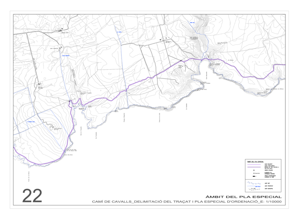
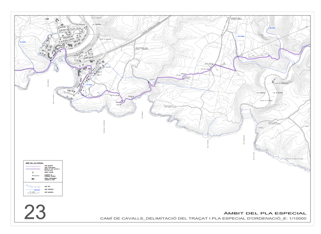
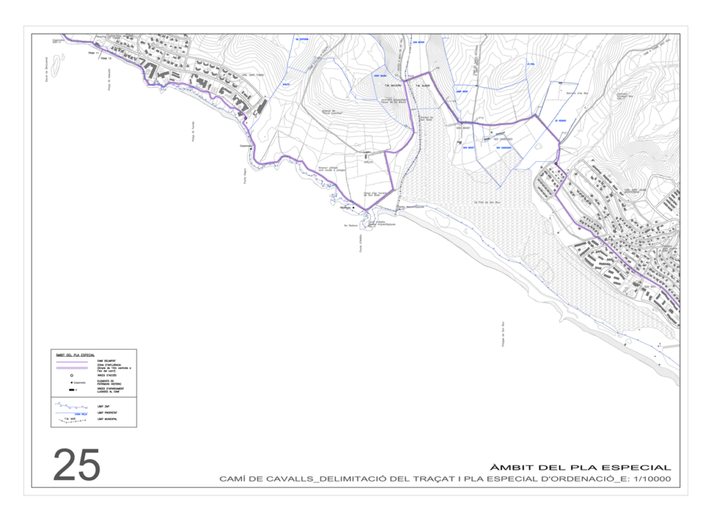
The Consell Insular de Menorca (CIME) published some maps with 26 sections of the Camí de Cavalls with a high level of detail. these maps are not considered updated. Despite it is not updated,they help me quite a lot when planning excursions, as it is very detailed..
- Download Maps of 25 stretches in PDF Format (Great Level of Detail)


Camí de Cavalls Frequently Asked Questions
Is it possible to cycle through the CdC on MTB-BTT?

Yes, but there are very complicated stretches and others that are simply impossible. If your plan is to cycle it all along (which is possible), you have to be in a very good shape as there will be many sections in which you will have to shoulder the bike.
My father (+50) made the entire tour of Camí de Cavalls by bike in 5 days (with some logistical support by road), so it is possible to do so.
Is the Camí de Cavalls well signposted?

Yes, the Camí de Cavalls is extremely well signposted. There are wooden “mojones/wooden poles” every 50 or 100 meters,so it’s hard to get lost.
If at some point you get lost, go back until you find the last”mojón/wooden pole” signaling the CdC.
Can you sleep/do bivouac on the beaches of Menorca?
No, it is forbidden, but a lot of people do so If you plan to do so it is essential to avoid the most touristic areas.
Bivouac or free camping: You can do bivouac outside the areas known as Natural Areas of Special Interest (ANEI). The problem is that these areas represent almost 40 of the island and include the entire coast.
- I’ve done bivouac and I know a lot of people who do.
- But keep in mind not doing bivouac on urban beaches and always look for a discreet site.
- Once I was fined by a policeman in Macarelleta for doing bivouac (within an ANEI, it is forbidden – the fine is justified).
Are dogs allowed in the beaches that pass through the CdC?

Short answer, you can not take dog to the beach from May to October.
There are a few exceptions in Es Migjorn, and in 2013 there were some actions to request that owners could go with their dogs.
What is the best time to do the CoC?
In my opinion, the best months to walk or cycle the Camí de Cavalls are May and September.
These are months with moderate temperatures (not too hot, not too cold) and with enough seasonal establishments open.
Is it possible to do the CdC in July-August or is it very hot?
In July and August it is very hot, but it is possible to make it if you can stand the high temperatures. You should carry little weight. A good advise is to avoid the sunniest hours.
I have done almost every stretch in August and you have to bring a lot of water. But it is without doubt the two worst months to make the CdC.
Where can I find accommodation in the CdC?
The hardest thing to tour the Camí de Cavalls is to find accommodation near it, especially on the North Coast.
- You can consult our
article where we recommend affordable accommodations near the Camí de Cavalls.
.
Where can I buy food and water along the CdC?
On the south coast it is easy to find supermarkets in each town and urbanization which you pass through.
On the north coast, you should bear in mind that from Cala Tirant to Cala Morell there is NO place to buy except the beach bar of Binimel-là Beach and the beach bar opened in 2018 in Cala Cavalleria.
- Please note that depending on the time of the year they may also be closed!
Are there water points or fountains in the CdC?
There are no fountains, there are bars and supermarkets in the urbanizations where you can buy water.
From November to April it is much harder to find water at these points, as some of them may be closed.
- Be very careful from Cala Tirant to Cala Morell, where you can only buy water at the beach bar of Binimel-là Beach and the beach bar opened in 2018 in Cala Cavalleria. Out of season (May-October) they may be closed!
What stages of the CdC can I do with Children?

In my opinion you could do all the stages in the south, but it depends on the age of the children and their physical shape.
Which stages of the CdC are best on foot?

A difficult question, as all of them have strengths and weaknesses.
I recommend the southern ones to see forested parts, and those of the north to see a wilder and a deserted landscape.
My favorites are:
- Stage 2: Es Grau to Favàritx.
- Stage 10: Punta Nati to Cales Piques
- Stage 13: Cala en Turqueta to Cala Galdana
Can I avoid Stage 1 of the Camí de Cavalls (the most dangerous for pedestrians)?
In 2022 it was planned to improve this part of the Camí de Cavalls to avoid hikers having to walk along the road. In the summer of 2023 it is still not finished.
Which stages of the CdC are the best in MTB?
Unless you are very good at Mountain Bike, I recommend these alternatives by bike.
- I’ve done CdC stages by bike and ended up taking longer than on foot because every time you shoulder the bike you waste a lot of time.
How can I combine stages by bike and on foot?
If you do not have support on the island (friends, family, acquaintances), it is best to hire the services of the companies that are dedicated to this.
Are there barbecues or cooking points in the CdC?
No, there is only one Barbecue area in Cala en Blanes.
- Be very careful to make fire, since Menorca is a Biosphere Reserve and it is forbidden to make fire in almost the entire coast.
What do the numbers on the posts of the Camí de Cavalls mean?
All the posts of the Camí de Cavalls have a red identification plate and 2 numbers painted on the wood in white.
- Top Number – 01 to 20: The number at the top indicates the section of the Camí de Cavalls.
- Bottom Number – 1 to 200: The number at the bottom indicates the remaining poles to the next leg.
These numbers are very important in case of problems along the route. If you give the rescue teams the numbers, they will know very precisely where you are on the road.
Remember that the Camí de Cavalls – GR-223 is very well signposted, so it is easy to find one of these posts, at least every 100 meters.


Pingback: Camí de Cavalls (185km) | teamMalin
Pingback: Cala Mitjana Beach | Menorca Diferente Guía de Turismo
Pingback: Cala Pregonda | Menorca Diferente Guía de Turismo