Section 10 of the Camí de Cavalls is the one that goes from Calespiques to the Punta Nati lighthouse. It is a stage of just over 5 km, of moderate difficulty and suitable for all ages provided it is done on foot. To go by Mountain bike is more difficult, because it is a very rocky route, and with some steep slopes along the way. You will most probably have to get off the bike in several places. Remember to bring a sweater in case the wind blows! Of course, you can start the route from any of the two points.
If you want to start the route from Punta Nati, the easiest option is to have someone drive you to the lighthouse. Starting from Calespiques is a little easier, since the Torres bus line 61 has a stop about 200 meters from the start of the route: the Torre del Ram stop (107). You can take the 61 from Ciutadella or from any of the intermediate stops and get off at the Torre del Ram stop. The route has 3 key landmarks: the famous Pont den Gil, Sa Falconera, and the Punta Nati lighthouse.Starting point stage 10 Camí de Cavalls
Llaut passing under Pont d’en Gil The Pont den Gil is a bridge over the sea next to Cala Corbetar. It is very famous for its unique appearance, and during the summer hundreds of small boats “play” to pass under the bridge. It is possible to take a dip and go under the bridge as it is possible to go down to sea level, but it is not recommended if there are many boats.
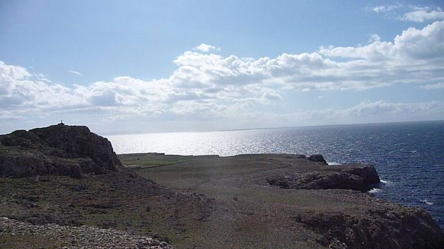
Sa Falconera
Sa Falconera Another landmark on the route is the viewpoint of Sa Falconera. It is a viewpoint on top of a cliff on the north coast, very exposed to the wind of Tramontana. From the viewpoint of Sa Falconera you can see the entire coast until you reach Punta Nati. You can also see Ciutadella and some of the nearby urbanizations.
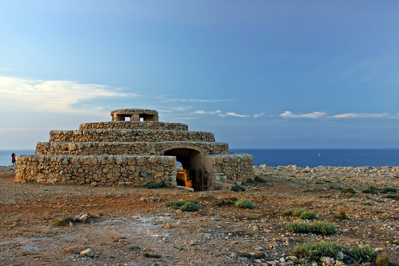
Punta Nati Lighthouse
Punta Nati Lighthouse If you still don’t know the Punta Nati Lighthouse… run to visit it. Located a few minutes (by car or bike) from Ciutadella,it is an ideal place to contemplate sunsetsand get lost in its cliffs and rocky landscapes. You can go there day and night, and the road to the lighthouse is paved and has a bike path. For all this, it can be reached by car, bike and on foot, which makes it a close and accessible destination that is usually crowded at sunset.
The recommended cycling network for mountain bikes has 6 main routes. The longest and perhaps also the most beautiful is the one that goes from Ciutadella to Ferreries. In addition to the official routes of the cycling network, there are 4 quite interesting routes suitable for all audiences.
S’Escala (or Es Portitxol) is the most accessible of all the beaches in the Favàritx Lighthouse area.
This beach is not usually very crowded because it has many rocks and stones, both in the sand and on the seabed.
As people prefer beaches with soft sand for the towel, they usually go to the neighboring beaches of Presili or Tortuga.
Section 15 of the Camí de Cavalls is the one that goes from the beach of Santo Tomás to the beach of Son Bou (the longest beach of Menorca).
It is a stretch of about 3km of distance of very easy difficulty that can be covered in less than 2 hours both on foot and by bike.
It can be done on foot without any problem and also by mountain bike.